
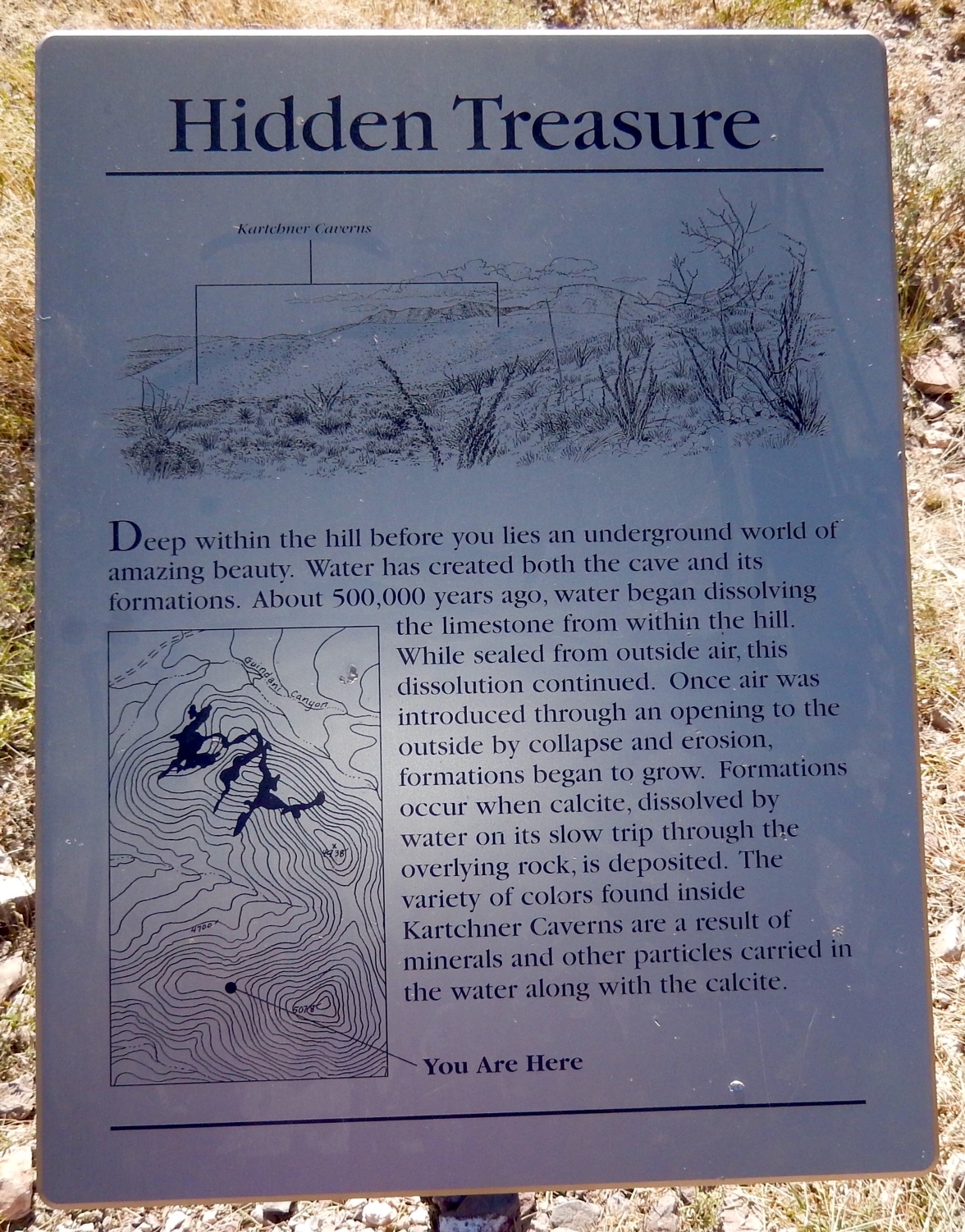
The Whetstone Mountains just south and west of Benson, reach a height of 7,711 ft on Apache Peak, rising from 4,800 ft at their mountains edges. Watersheds on the eastern side drain into the San Pedro River, while those on the western side feed Cienega Creek and thus flow into the Tucson basin. Starting at Kartchner Caves State park you can take two hikes from the campground, into the Whetstones, one that circles the hills that contain the caves (the foot hills trail) and the second, the Guindana trail that leaves the state park entering the Coronado National Forest. The second trail, is named for the canyon it navigates and is home to old mines no longer in use. The little I have been able to find indicates that they were mines for novaculite, a mineral used for whetstones for which the Whetstones mountains were named. But this area is mineral rich and is threatened by the copper mining companies in the area. Time will tell if the statues of national forest will keep these relatively unexplored mountains safe from further mining. I'll keep my fingers crossed
No comments:
Post a Comment